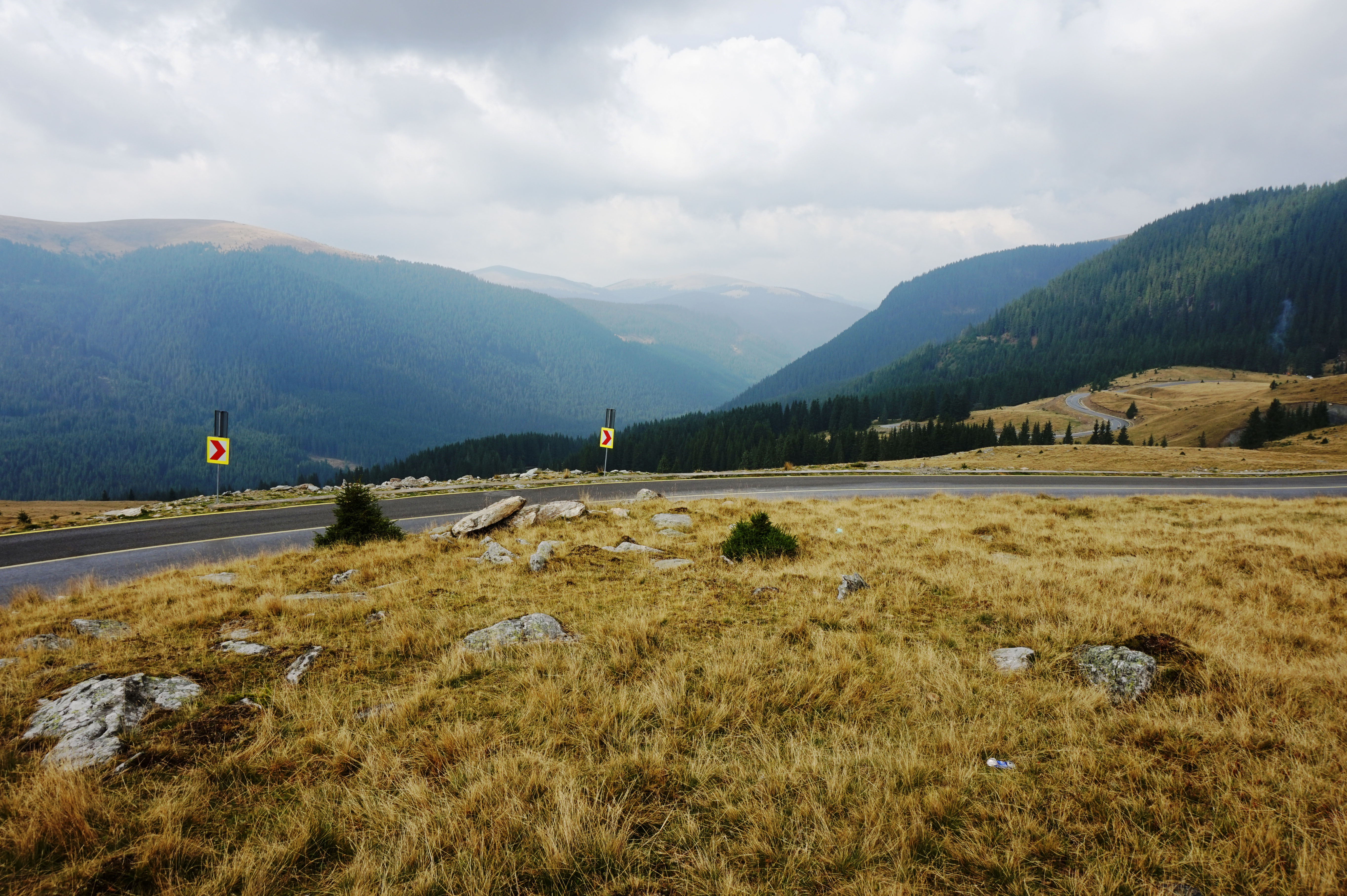
The TransAlpina (translated as Trans-Alpine) highway is located in the Southern Carpathian mountain range of Romania. It is a breathtaking scenic drive, not to be missed in Romania. Only 140 km of road is enough to leave you breathless! The highest point in Romania is located on the TransAlpina, at 2145 meters.
Before planning your trip, it is important to know that the highway is only open from May to September, and that is subject to change depending on the weather. Likewise, the highway may close in case of stormy weather advisories, as some parts of this highway are dangerous to drive in bad weather.
A Bit of History
One of the oldest roads over the Carpathian Mountains, the TransAlpina was built by the Romans at the beginning of the 2nd Century AD, during their mission in the war to conquer Dacia (which is today Romania). Back then, the highway was named “The King’s Road”. After the occupation of Dacia, the Romans used this highway for the transportation of gold from Transylvania, back to Rome. By the start of the second millennium, the TransAlpina become one of the most important routes over the Carpathians, and still serves this purpose today. The highway was inaugurated in 1938 by King Carol II.
Getting there
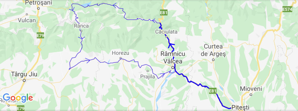
There are numerous ways to get to the TransAlpina. Travelers who have 2 days or more can start off in Sibiu, drive 66 km northwest along highway E81 to the town of Sebes, where the TransAlpina (highway DN67C) starts southbound, and heads 140 km to the town of Novaci. Although 140 km sounds pretty fast, in order to experience all the beauty this highway has to offer, one would need to overnight somewhere along the way.
For those traveling from Bucharest and have only one day, the best route would be to drive west along highway E81 (same highway that reaches Sibiu) for about 2.5 hours, past Pitesti, to the town of Ramnicu Valcea. From there, continue along E81 for another 40 minutes, to the town of Caciulata, where you will turn west along highway 7A. This highway will lead you to the TransAlpina.
Sights along the journey
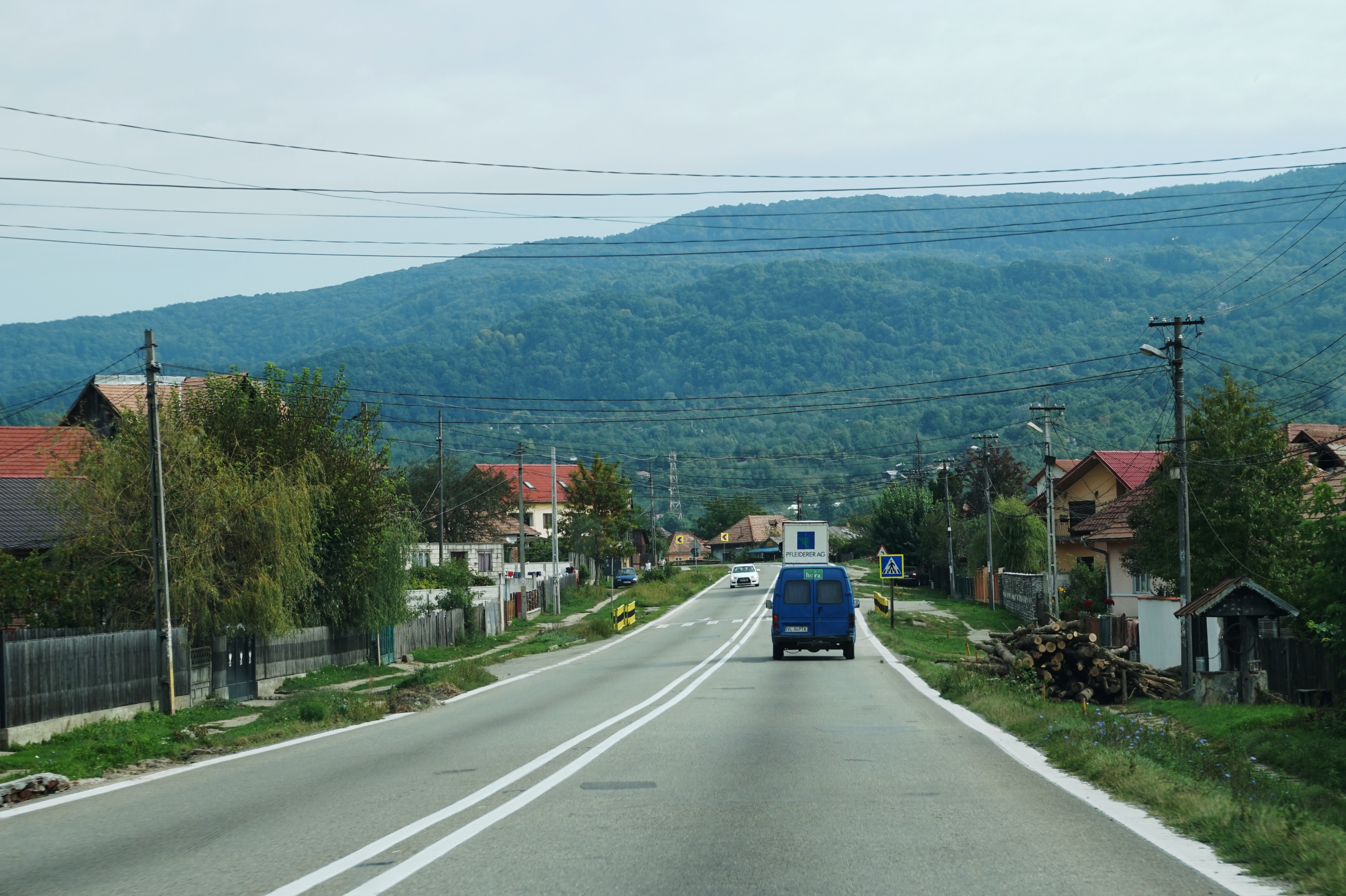
Once you reach the town of Caciulata and turn west on highway 7A, the climbing begins. Most of the attractions along this highway are landscapes. After the highway descends back to the ground, one can find monasteries and caves. For those who have more than one day, there are lots of hotels, as well as Bed & Breakfasts (known as “Pensiune”, which translates to “Guest House”) for those who enjoy meeting the locals. When you reach one of the many villages along the way, you will find one or two restaurants per village, which serve mostly Romanian and Eastern European foods. Be ready to try the Romanian food, because one will not find McDonalds or any fast-food chain along this highway.
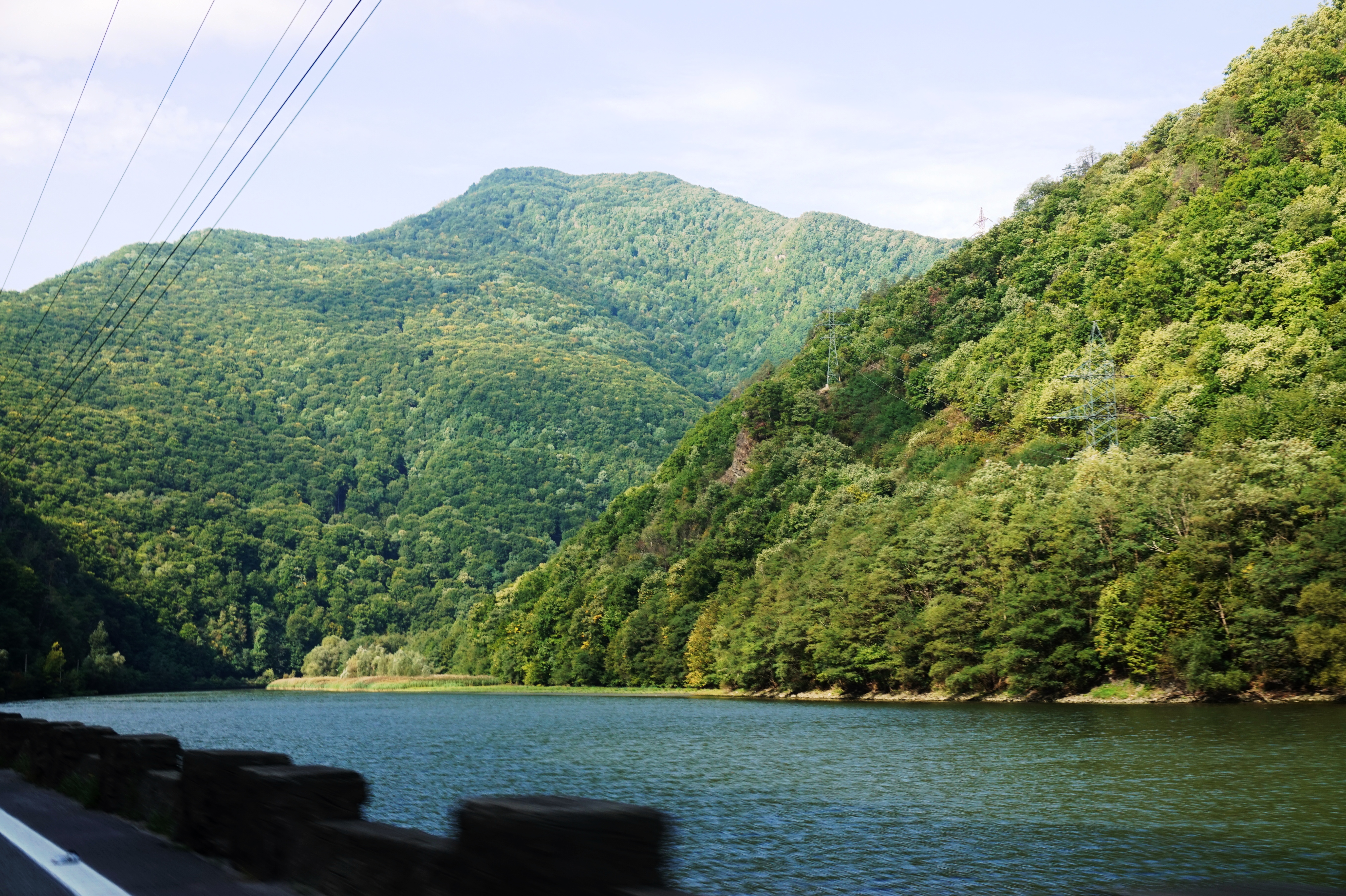
Bradisor Lake
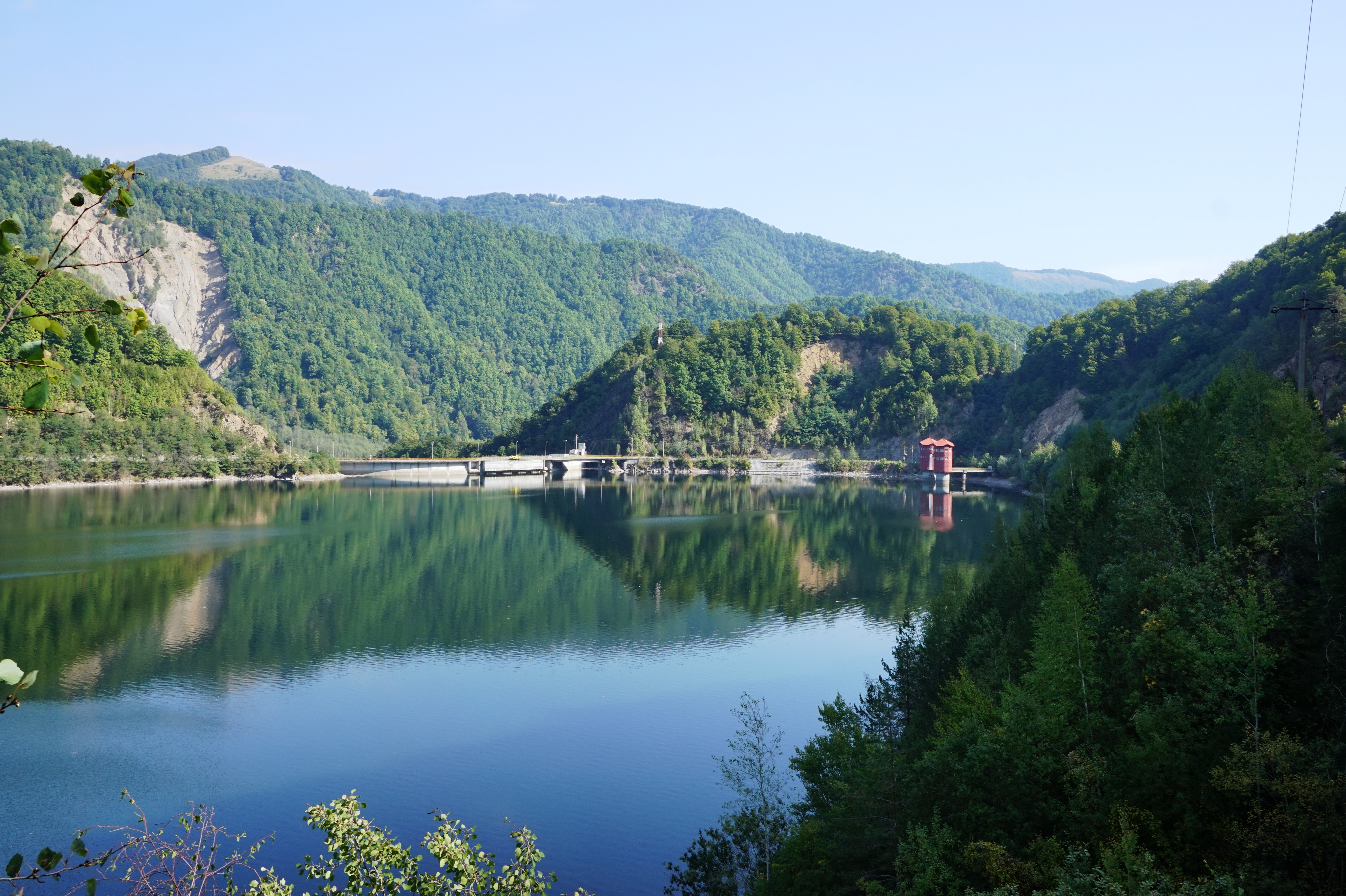
Vadra Lake
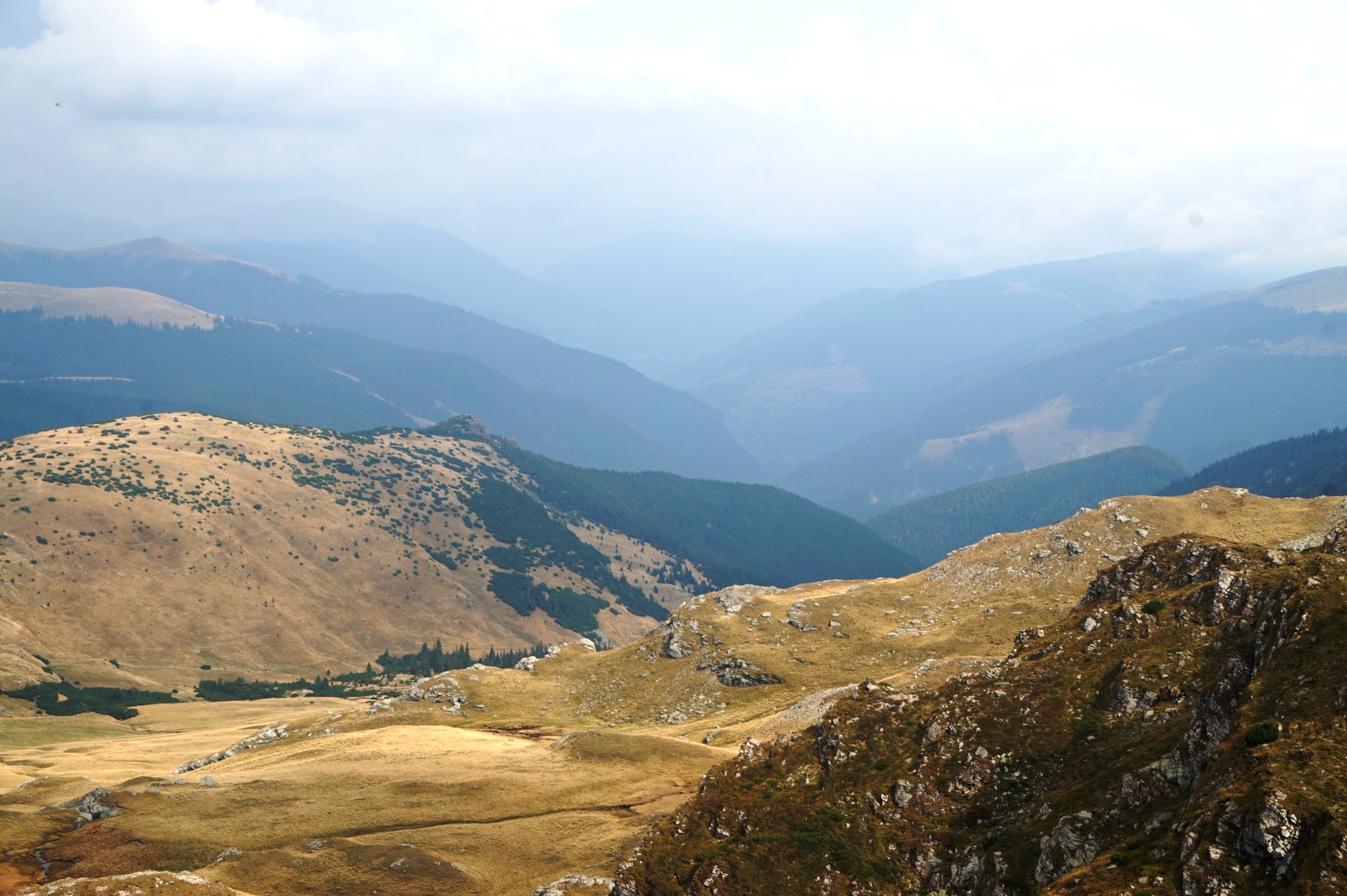
Urdele Pass (Pasul Urdele) – highest peak at 2,145 meters
Ranca
Located at an elevation of 1,600 meters in the Parang Mountains, Ranca is one of the major stops along the TransAlpina. In the winter, this town becomes a ski resort. For adventure buffs, paragliding can be found at Papusa Peak, Magura Peak or Cerbul Peak.
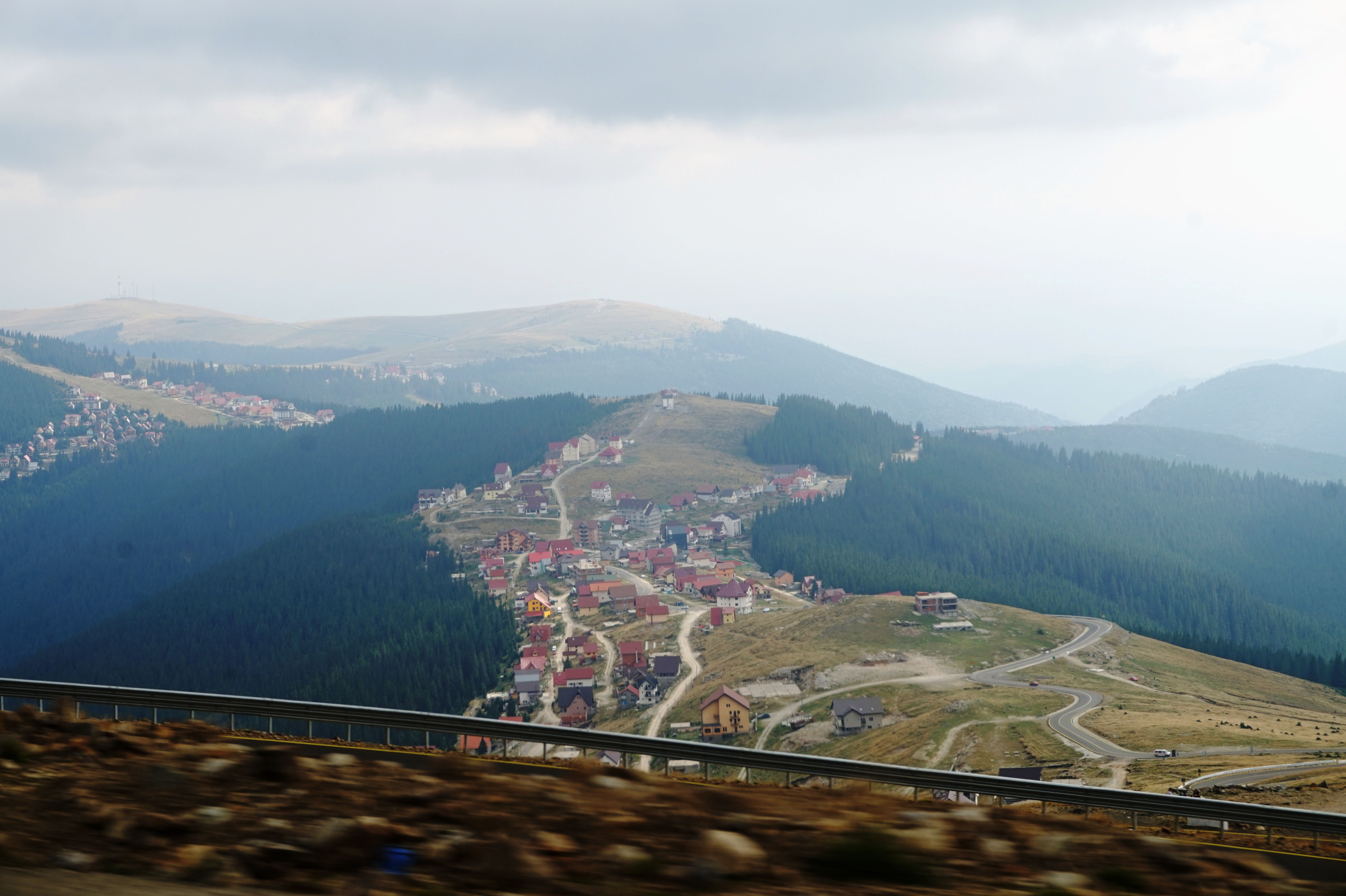
For those who plan to start in Sebes and stay overnight, this is an ideal spot. After the amount of beauty that the TransAlpina brings, you would reach Ranca around 9:00 p.m. Although Ranca is located about 20 km away from the town of Novaci, where the highway ends, descending towards Novaci plus visiting the monasteries and caves that one finds after the highway ends can be another full day’s trip.
If you book a hotel in Ranca, it is important to check the hotel’s front desk hours. Most travelers are used to hotels having 24-hour front desk service. However, in Europe, many small and/or independent hotels do not have that. This is especially true for hotels in the countryside which do not get loads of guests every day. It is always a good idea to advise the hotel what time you plan to arrive.

End of the highway
The highway ends in the town of Novaci. The descend is quite an experience itself. However, the beauty and nature does not end there. Once you reach Novaci, instead of continuing along the TransAlpina and calling it “the end of breathtaking landscapes”, turn east along County Road 665, as seen in the maps below:


It is along this road that one will find monasteries and caves. About 15 km from Novaci, you will hit the village of Baia de Fier, and County Road 665 will continue southbound towards the town of Polvragi. Instead of continuing along 665, turn north, and you will reach the historical Manastirea Polovragi (Polovragi Monastery). A bit further, you will reach Pesterea Polovragi (The Polovragi Cave).
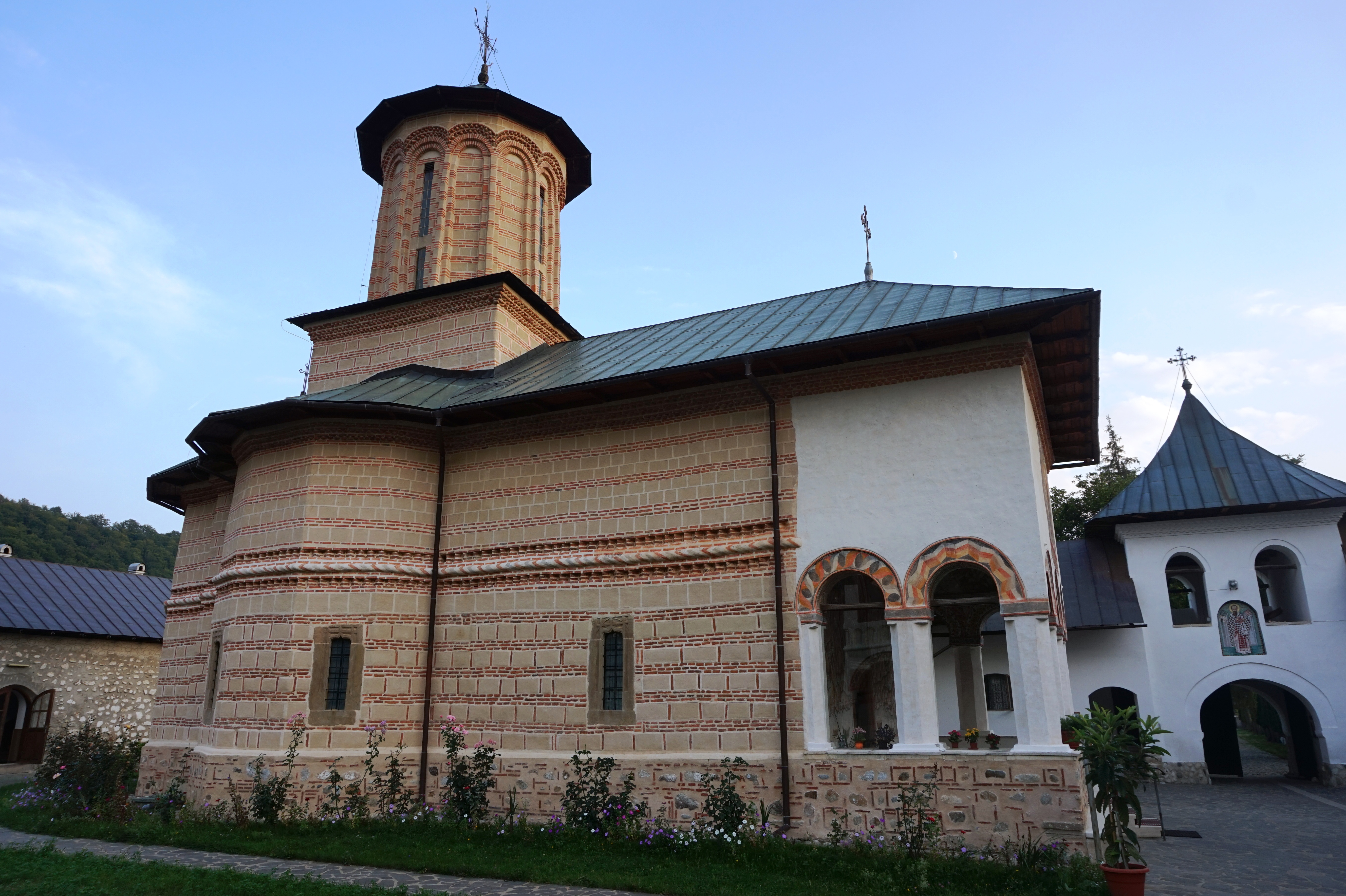
Polovragi Monastery
Built in 1643, the Polovragi Monastery is a monastery of nuns, classified as a historical monument. Located at the foot of Polovragi Stone Montain, the entrance to the monastery has a big wooden gate, where it is written in Romanian: “Blessed is he who comes in the name of the Lord”. One will also find a beautifully carved concrete pedestal, dedicated to Romanian heroes and martyrs.
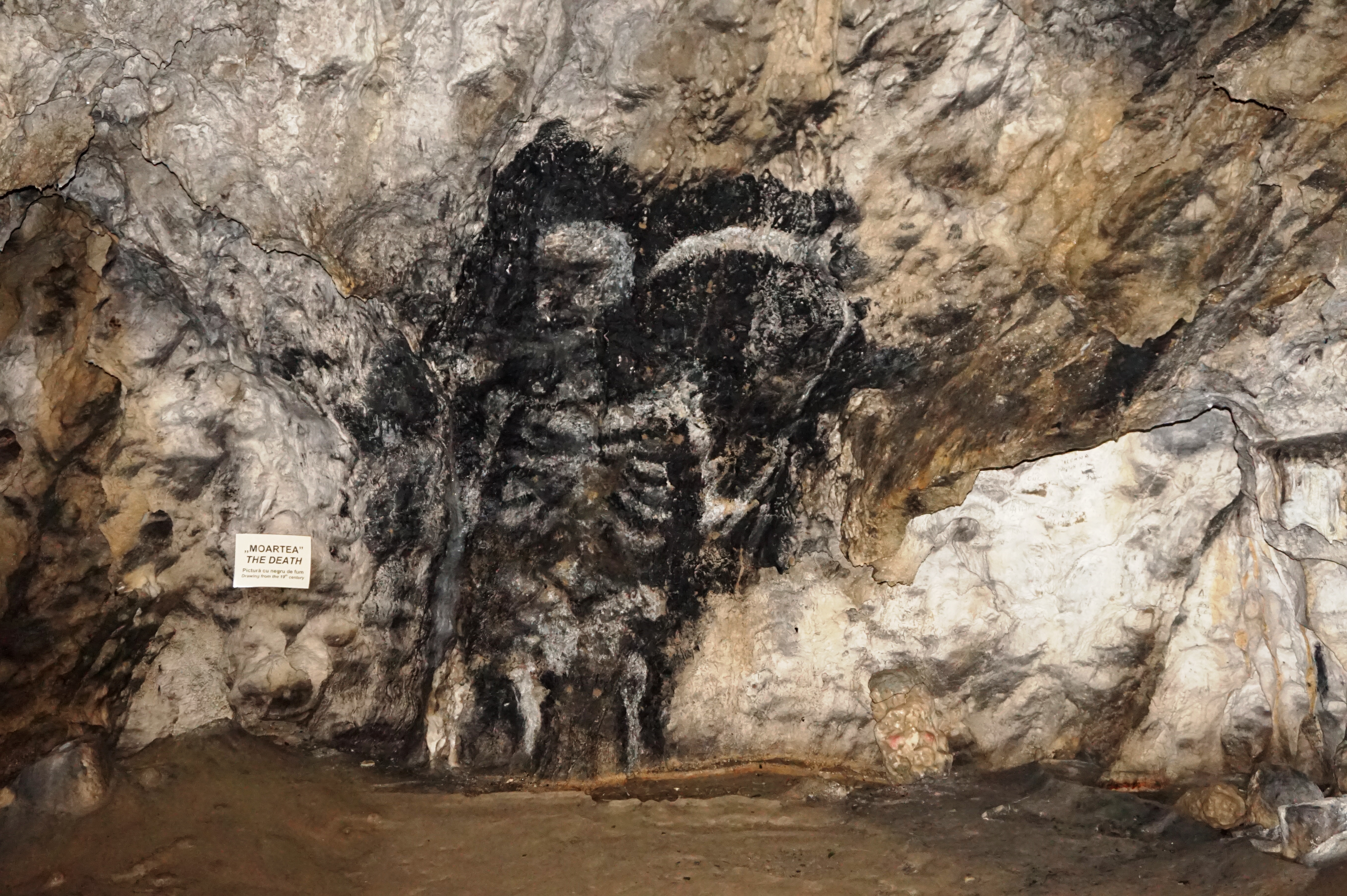
Polovragi Cave
Burdened by history and spirit, Polovragi Cave is identified with the idea that healers of the period used a plant called Polovraga to make antidotes for different diseases. The cave contains rich cave bear remains, and one will also see a human skull. The name is kept according to that legend. Inside the caves, the temperature is about 8-9 degrees Celsius, which makes it convenient for visiting at any time of the year.
End of the journey
After finishing the Polovragi area, one can continue along County Road 665 towards Ramnicu Valcea, and Bucharest is about 2-2.5 hours drive from there. There are more monasteries as well as a few more villages between Polovragi and Ramnicu Valcea, so the more time you have, the more you can visit.
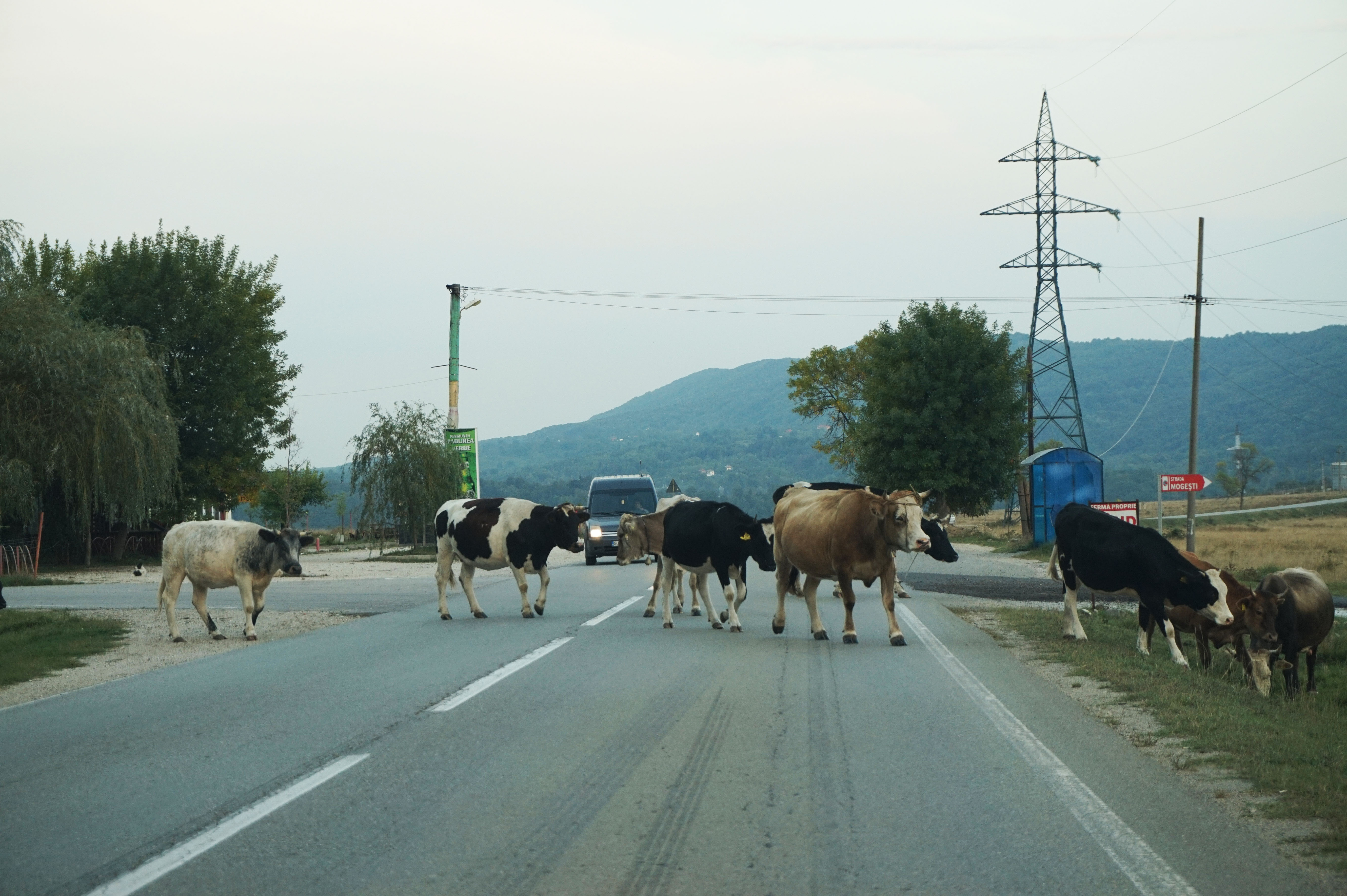
It is important to be careful when driving down county roads, as you may see animals like cows and sheep crossing the road. Sometimes there may be just one, other times you could see a herb of them crossing. This is common anywhere in the countryside of Romania.
The TransAlpina is a truly breathtaking drive, which will leave you rich in experiences and memories. It is open from May to October, however, it is subject to closure in case of bad weather which can make the drive dangerous. Click here to check the current conditions. The route is a total of about 3-4 hours without stops. However, travelers who want to see all the beauty and take great pictures can expect the drive to last all day. For a complete experience, it is best to save 2 full days to cover the entire highway.